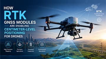
RTK (Real-Time Kinematic) is becoming a core positioning technology in modern UAV systems. Compared with traditional GNSS navigation, RTK enables drones to achieve centimeter-level positioning accuracy using real-time correction data.
This level of precision is increasingly important for drone mapping, precision agriculture, industrial inspection, and autonomous flight. Standard GNSS positioning may drift by several meters, while RTK drones can maintain stable and repeatable flight paths for high-accuracy operations.
Today, RTK GNSS modules are no longer limited to surveying equipment. They are becoming a foundational component in next-generation autonomous drone systems.
In this article, we will explore how RTK GNSS modules work in drones, the key technical specifications that matter for UAV integration, major application scenarios, integration challenges, and the future trends shaping high-precision drone navigation systems.
RTK (Real-Time Kinematic) is a high-precision GNSS positioning technology that improves positioning accuracy from meters to centimeters through real-time differential correction.
An RTK drone system typically includes:
· A base station
· A rover receiver installed on the drone
· A correction data link
The base station calculates satellite positioning errors and sends correction data to the drone in real time. The RTK rover then uses these corrections to generate highly accurate position data.
The RTK positioning workflow in drones is relatively simple:
Step | Function |
Satellite Reception | Receives GNSS signals from GPS, BeiDou, Galileo, etc. |
Base Station Calculation | Calculates positioning correction data |
Data Transmission | Sends RTCM corrections via NTRIP, 4G/5G, or radio |
RTK Positioning | Drone calculates centimeter-level coordinates |

When the RTK system successfully resolves carrier-phase ambiguities, it enters a Fixed state with centimeter-level accuracy.
If correction quality decreases, the system may switch to a Float state with lower positioning precision.
Feature | Standard GNSS | RTK GNSS |
Position Accuracy | Meter-level | Centimeter-level |
Flight Repeatability | Limited | High |
Mapping Precision | Moderate | Very High |
Autonomous Flight Stability | Lower | Higher |
Precision Agriculture | Limited | Excellent |
RTK drones are especially valuable for applications requiring accurate waypoint tracking and repeatable autonomous flight.
RTK significantly improves aerial mapping accuracy.
Traditional drone surveying often requires multiple Ground Control Points (GCPs), which increase fieldwork time and labor costs. RTK drones can reduce or even eliminate many GCP requirements by recording highly accurate position data directly during flight.
Benefits include:
· Faster surveying workflows
· Improved orthomosaic accuracy
· Better 3D reconstruction
· Reduced field labor
RTK is now widely used in:
· Land surveying
· Construction mapping
· Mining
· Infrastructure planning
In agricultural UAV operations, positioning accuracy directly affects spraying quality, resource efficiency, and crop management performance.
Traditional GNSS positioning may introduce flight path deviations that cause overlapping spray coverage or untreated gaps between routes. Over time, these inaccuracies can lead to wasted chemicals, inconsistent crop treatment, and increased operational costs.
RTK-enabled agricultural drones can maintain centimeter-level route accuracy, allowing flight paths to align much more precisely with field boundaries and crop rows. This helps improve spraying consistency while reducing overlap and missed coverage.
RTK positioning also supports advanced precision agriculture workflows such as:
· Automated route planning
· Breakpoint resume functionality
· Variable-rate spraying
· Orchard management
· Field re-surveying and data comparison
As precision farming continues to evolve, RTK is becoming a key enabling technology for intelligent agricultural drone systems.

Inspection drones often need to fly the same route repeatedly for consistent image comparison.
RTK improves:
· Flight repeatability
· Waypoint accuracy
· Autonomous inspection reliability
· Position stability near infrastructure
Typical RTK inspection scenarios include:
· Power line inspection
· Wind turbine inspection
· Bridge inspection
· Mining operations
In addition, many industrial environments contain strong electromagnetic interference sources, metal structures, and signal reflections that can negatively affect navigation systems. RTK systems with robust anti-interference capability and multi-constellation support can improve positioning reliability in these challenging conditions.
When combined with obstacle avoidance systems, visual recognition, and automated mission planning, RTK helps enable more autonomous and repeatable inspection workflows.
As drone swarm technology continues developing, high-precision positioning is becoming increasingly important for coordinated UAV operations.
In swarm applications, multiple drones must maintain accurate relative positions while executing synchronized flight tasks within limited airspace. Position drift or timing inconsistency can affect formation accuracy and increase collision risks.
RTK provides a unified high-precision spatial reference for all drones within the swarm system. By sharing consistent positioning and timing information, UAVs can perform coordinated maneuvers with improved stability and synchronization.
Typical applications include:
· Drone light shows
· Coordinated logistics operations
· Multi-UAV mapping missions
· Collaborative industrial inspection
· Autonomous fleet management
RTK not only improves positioning accuracy, but also helps establish the reliable spatial foundation required for scalable autonomous drone operations.
Choosing the right RTK GNSS module is critical for building stable and reliable UAV systems. In drone applications, positioning accuracy alone is not enough. Factors such as fix stability, recovery speed, update latency, anti-interference capability, and system integration all directly affect real-world flight performance.
The table below summarizes the most important RTK GNSS module specifications for drones.
Specification | Why It Matters for UAVs | Typical Requirements |
Position Accuracy | Determines mapping precision and flight path consistency | Centimeter-level accuracy |
RTK Fix Rate | Affects positioning stability during operation | Stable Fixed solution |
Initialization Time | Impacts takeoff preparation and recovery after signal blockage | Fast TTFF and re-fix |
Update Rate | Reduces flight control latency | 10 Hz–20 Hz |
Multi-Constellation Support | Improves satellite availability in complex environments | GPS / BDS / Galileo / GLONASS |
Anti-Interference Capability | Improves reliability near power lines or industrial structures | Strong RF filtering and shielding |
Interfaces | Ensures compatibility with flight controllers | UART / CAN / PPS |
Power Consumption | Affects UAV endurance and thermal design | Low-power operation |
Module Size | Important for compact drone integration | Lightweight and compact design |
Position accuracy is one of the primary reasons drones adopt RTK technology. In UAV systems, RTK positioning accuracy is typically evaluated at the system level using specifications such as:
· Horizontal Accuracy: ~1 cm + 1 ppm
· Vertical Accuracy: ~1.5 cm + 1 ppm
Centimeter-level positioning allows drones to:
· Follow repeatable flight paths
· Improve aerial mapping precision
· Perform accurate automated landing
· Reduce overlap in agricultural spraying
· Maintain stable positioning during inspection missions
However, practical drone performance depends not only on theoretical accuracy, but also on environmental conditions, antenna design, correction quality, and system integration.
For UAV applications, maintaining a stable RTK Fixed solution is often more important than peak positioning accuracy.
A drone operating in Float mode may experience noticeable positioning drift, which can affect:
· Mapping consistency
· Flight path tracking
· Autonomous hovering
· Precision spraying
· Inspection repeatability
Two important performance indicators are:
Parameter | Description |
TTFF (Time To First Fix) | Time required for the module to acquire satellite positioning |
RTK Fix Time | Time required to enter RTK Fixed mode |
Drone systems also require fast recovery after temporary signal interruptions caused by trees/buildings/bridges/industrial structures/RF interference.
A module with fast re-fix capability can significantly improve flight continuity and mission reliability.
Modern RTK GNSS modules typically support multiple satellite constellations and frequency bands simultaneously.
Common supported systems include:
· GPS
· BeiDou (BDS)
· Galileo
· GLONASS
The advantages of multi-constellation support include:
· Increased visible satellite count
· Better positioning stability
· Improved urban and industrial performance
· Faster RTK initialization
· Higher Fixed solution probability
For drone applications operating near buildings, forests, mountains, or power infrastructure, multi-band RTK significantly improves positioning robustness.
Drone flight controllers require continuous, low-latency positioning updates to maintain stable navigation.
A higher RTK update rate improves:
· Flight responsiveness
· Trajectory smoothness
· High-speed maneuvering
· Autonomous route tracking
Typical RTK update rates for drones include:
Update Rate | Typical Use Case |
1 Hz–5 Hz | Basic navigation |
10 Hz | Standard UAV automation |
20 Hz | High-speed or precision flight control |
Low positioning latency is equally important because delayed position data can introduce control lag during autonomous flight operations.
UAVs often operate in environments with significant electromagnetic interference and signal reflection.
Common interference sources include:
· Power transmission lines
· Motors and ESCs
· Industrial machinery
· Metal structures
· Wireless communication systems
A high-quality RTK GNSS module should include strong RF design features such as:
· SAW filters
· Low-noise amplifiers (LNA)
· Shielding structures
· Anti-multipath optimization
· Stable RF front-end architecture
Proper anti-interference performance helps maintain stable RTK Fixed status in challenging environments.
RTK modules must integrate smoothly with UAV flight control systems and onboard electronics.
Common drone integration interfaces include:
Interface | Function |
UART | GNSS data transmission |
CAN | High-reliability communication |
PPS | Precise timing synchronization |
Event Mark | Camera trigger synchronization |
Additional integration considerations include:
· Compact module size
· Lightweight design
· Thermal management
· Low power consumption
· Vibration resistance
In many UAV projects, antenna placement and system integration quality can have a greater impact on RTK performance than the module specifications themselves.
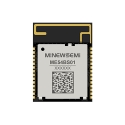
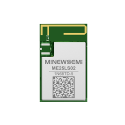
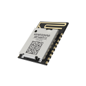
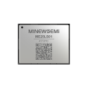
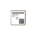
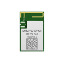
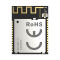
For commercial UAV applications requiring compact integration and stable RTK positioning performance, modules such as the ME3RGR01 can support high-precision drone navigation and mapping workflows.
Accurate positioning alone is not always sufficient for autonomous UAV navigation. Drones also require reliable heading information.
Traditional UAV systems often use magnetic compasses, but compass performance can degrade near:
· Power lines
· Steel structures
· Industrial equipment
· Electric motors
This is where dual-antenna RTK becomes important.
Dual-antenna RTK systems use two GNSS antennas to calculate heading directly from satellite signals.
Compared with magnetic compasses, dual-antenna RTK provides:
Feature | Benefit |
Satellite-Based Heading | No geomagnetic dependence |
Higher Heading Accuracy | Better flight stability |
Better EMI Resistance | Improved industrial reliability |
Real-Time Heading Output | Better autonomous navigation |
This approach is increasingly used in industrial and autonomous drone systems.
Dual-antenna RTK is commonly used in:
· Power line inspection drones
· Mining UAVs
· Bridge inspection
· Vehicle-mounted drone systems
· Autonomous industrial UAVs
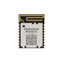
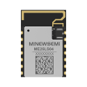
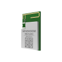
For applications requiring both precise positioning and stable heading detection, dual-antenna RTK modules such as the MS36SN4 can improve navigation stability in complex environments.
No single positioning technology can guarantee stable navigation in every environment.
Modern autonomous drones increasingly combine:
· RTK GNSS
· IMU sensors
· Visual Inertial Odometry (VIO)
through multi-sensor fusion.
Each navigation technology has different strengths.
Technology | Strengths | Limitations |
RTK GNSS | High-accuracy global positioning | Sensitive to blockage and interference |
IMU | High-frequency motion tracking | Accumulates drift over time |
VIO (Visual Inertial Odometry) | Good local motion estimation | Depends on lighting and visual features |
By combining these technologies, drones can maintain more stable navigation during temporary GNSS interruptions.
Future autonomous drones will increasingly rely on:
· RTK + INS deep coupling
· VIO-assisted navigation
· PPP-RTK correction services
· Multi-UAV coordination
· Anti-spoofing technologies
RTK is gradually evolving from a standalone positioning technology into part of a complete intelligent navigation system.
The ME3RGR01 is designed for commercial UAV applications requiring stable centimeter-level RTK positioning.
Typical applications include:
· Drone mapping
· Precision agriculture
· Autonomous route navigation
· Industrial inspection
Its compact design and multi-constellation support make it suitable for modern UAV integration.
The MS36SN4 is a dual-antenna RTK module designed for UAV applications requiring both positioning and heading detection.
Typical use cases include:
· Power line inspection
· Industrial UAV systems
· Autonomous navigation
· Complex electromagnetic environments
The dual-antenna architecture helps improve heading stability and navigation reliability.
RTK is becoming the positioning foundation for modern autonomous drone systems.
Compared with traditional GNSS navigation, RTK enables:
· Centimeter-level positioning
· Repeatable flight paths
· More accurate mapping
· Precision agriculture
· Reliable industrial inspection
As UAV automation continues advancing, RTK GNSS modules will increasingly integrate with IMU, VIO, and intelligent sensor fusion technologies to support next-generation autonomous navigation systems.
High-precision positioning is no longer just a surveying feature — it is becoming a core capability of intelligent drones.
RTK (Real-Time Kinematic) is a high-precision GNSS positioning technology that improves drone positioning accuracy from meters to centimeters using real-time correction data.
RTK drone systems typically achieve centimeter-level positioning accuracy, often around:
· Horizontal accuracy: 1 cm + 1 ppm
· Vertical accuracy: 1.5 cm + 1 ppm
Actual performance depends on factors such as satellite visibility, correction data quality, antenna design, and environmental interference.
Standard GNSS provides meter-level positioning accuracy, while RTK uses correction data and carrier-phase calculations to achieve centimeter-level precision.
Most RTK drone systems require access to correction data generated by a base station or correction network.
Correction data can be received through:
· Local RTK base stations
· NTRIP correction services
· 4G/5G networks
· Radio telemetry links
Some emerging technologies such as PPP-RTK may reduce dependence on local base stations in the future.
Dual-antenna RTK provides precise heading information without relying on magnetic compasses, improving navigation stability in complex electromagnetic environments.
Yes. RTK improves orthomosaic accuracy, reduces Ground Control Point requirements, and supports highly repeatable aerial surveying workflows.
Yes. RTK allows agricultural drones to follow highly accurate flight paths with centimeter-level consistency.
This helps:
· Reduce overlap spraying
· Prevent missed coverage
· Improve route consistency
· Support variable-rate application
· Improve overall precision farming efficiency
RTK is becoming a core technology in modern precision agriculture systems.
If a drone temporarily loses RTK Fixed status due to signal blockage or interference, positioning accuracy may decrease.
Modern UAV systems often use:
· IMU sensors
· Visual Inertial Odometry (VIO)
· Sensor fusion algorithms
to maintain short-term flight stability until RTK positioning recovers.
The recovery speed and overall system stability depend on the quality of both the RTK module and the UAV navigation architecture.