

When discussing satellite navigation, the terms GNSS and GPS are often used interchangeably. You may see them in smartphone specifications, vehicle tracking devices, drones, and IoT positioning solutions. Although they are closely related, they do not mean exactly the same thing.
GPS is one satellite navigation system, while GNSS is the broader term for satellite navigation systems worldwide. GNSS can include GPS, Galileo, BeiDou, GLONASS, and other regional systems. A GNSS receiver that supports multiple constellations can use signals from more than one system to determine its position.
Understanding the difference between GNSS and GPS is useful when choosing a positioning solution for an IoT device or an embedded system. The right choice depends on factors such as positioning requirements, signal availability, power consumption, operating environment, and overall system cost.
In this guide, we explain how GNSS and GPS differ, how they work, and what the distinction means when selecting a GNSS module for your application.
GNSS stands for Global Navigation Satellite System. It refers to satellite-based systems that provide positioning, navigation, and timing information to compatible receivers.
A GNSS receiver determines its location by processing signals transmitted by navigation satellites. These signals contain information that allows the receiver to estimate the distance between itself and multiple satellites. By combining measurements from several satellites, the receiver can calculate its position.
GNSS is an umbrella term rather than the name of a single satellite system. It includes several independently operated systems that provide global or regional navigation services.
Depending on its design, a GNSS receiver may support one constellation or multiple constellations. A multi-constellation receiver can use signals from several systems, potentially increasing the number of satellites available for positioning.
This capability is particularly useful in applications where positioning continuity matters, such as asset tracking, fleet management, drones, and industrial IoT devices.
GNSS positioning relies on measuring the travel time of radio signals transmitted by satellites. Because the signals travel at approximately the speed of light, the receiver can use their arrival times to estimate its distance from each satellite.
In simplified terms, the process involves three steps:
Satellite signal transmission: Navigation satellites broadcast signals containing timing information and satellite navigation data.
Signal reception and measurement: A GNSS receiver uses an antenna to receive the signals and calculates the corresponding satellite-to-receiver distance measurements.
Position calculation: The receiver combines measurements from multiple satellites to estimate its position and, depending on the solution, its velocity and timing information.
A receiver typically needs signals from at least four satellites for a conventional three-dimensional position solution that also estimates its receiver clock error. Additional satellites can improve measurement redundancy and may improve positioning performance, depending on satellite geometry and signal conditions.
The actual result also depends on signal quality, atmospheric effects, multipath interference, antenna performance, and the receiver's processing algorithms.
GPS stands for Global Positioning System. It is a satellite navigation system developed and operated by the United States.
GPS satellites transmit signals that compatible receivers can use to calculate their positions, velocities, and timing information. GPS is widely used in consumer electronics, transportation, surveying, agriculture, and industrial applications.
For example, a smartphone can use GPS signals to determine its location for mapping and navigation. A vehicle tracking device can use GPS positioning to report a vehicle's location to a fleet management platform.
GPS is one of the most widely recognized satellite navigation systems, which is why people often use “GPS” as a general term for satellite positioning. Technically, however, GPS refers specifically to the U.S. system.
A receiver described as GPS-enabled may support GPS alone or may also support other GNSS constellations. The product specifications should be checked to confirm which systems it can actually use.
GPS uses the same basic positioning principle as other GNSS systems.
GPS satellites transmit radio signals that include precise timing information and navigation data. A GPS receiver measures the signals from multiple satellites and uses these measurements to calculate its position.
GPS positioning does not inherently require an internet connection. A receiver can calculate its position from satellite signals, although a device may use network connectivity or assistance data to speed up acquisition or provide additional services.
In practice, GPS performance depends on the receiver, antenna, satellite visibility, and surrounding environment. Buildings, dense foliage, tunnels, and other obstructions can weaken or block satellite signals.
The main difference between GNSS and GPS is their scope. GNSS refers to the broader category of satellite navigation systems, while GPS is one specific system within that category.
Comparison | GNSS | GPS |
Full name | Global Navigation Satellite System | Global Positioning System |
Meaning | General term for satellite navigation systems | The U.S. satellite navigation system |
Satellite systems | Can include GPS, Galileo, BeiDou, GLONASS, and supported regional systems | GPS satellites |
Receiver support | Depends on the receiver; may support one or multiple constellations | Refers to GPS signal support |
Satellite availability | A multi-constellation receiver may access more satellites across supported systems | Depends on available GPS satellites and signal conditions |
Positioning performance | Depends on supported systems, signals, hardware, and algorithms | Depends on GPS signal conditions, hardware, and algorithms |
Typical applications | IoT tracking, drones, navigation, agriculture, and industrial positioning | Navigation, tracking, timing, and many other applications |
It is important to understand that GNSS and GPS are not competing technologies in the usual sense. GPS is part of the GNSS landscape, and many GNSS receivers include GPS support.
The more useful comparison is often between a GPS-only receiver and a multi-constellation GNSS receiver. The latter may have access to signals from several satellite systems, depending on its capabilities and the environment.
Several satellite navigation systems are used around the world. Their availability in a particular receiver depends on the hardware, firmware, supported signals, and regional conditions.
GPS is operated by the United States and provides global positioning, navigation, and timing services. It is widely supported by smartphones, vehicle navigation systems, wearable devices, and embedded positioning modules.
GPS remains an important component of many GNSS solutions and is frequently supported alongside other satellite systems.
Galileo is the European Union's global satellite navigation system. It provides positioning and timing services and is designed to work alongside other GNSS systems.
Receivers that support both GPS and Galileo can combine measurements from the two systems when suitable signals are available. This can increase the number of usable satellites and improve positioning availability in some environments.
BeiDou is China's global satellite navigation system. It provides positioning, navigation, and timing services and supports applications ranging from consumer navigation to transportation and industrial systems.
For developers working with products intended for different markets, BeiDou support may be relevant alongside GPS, Galileo, and other constellations.
GLONASS is Russia's global satellite navigation system. It can provide positioning services worldwide and is supported by many multi-constellation receivers.
When a receiver supports GLONASS in addition to other systems, it may have access to more satellites, depending on visibility and signal conditions.
The Quasi-Zenith Satellite System (QZSS) is a regional satellite navigation system designed primarily to enhance positioning services in Japan and surrounding areas.
Its satellite configuration is intended to improve satellite visibility and positioning availability in the region, including environments where buildings may obstruct signals from satellites at lower elevation angles.
NavIC, also known as the Navigation with Indian Constellation, is India's regional satellite navigation system. It is designed to provide navigation services over India and surrounding areas.
Support for NavIC can be relevant to products targeting applications in its service region, but receiver compatibility depends on the specific signals and frequencies implemented.
GPS, Galileo, BeiDou, and GLONASS are generally classified as global navigation satellite systems. QZSS and NavIC are regional systems designed to provide services in their intended coverage areas.
A receiver does not automatically support every constellation simply because it is described as a GNSS receiver. Always check the datasheet for supported satellite systems, signal bands, and other receiver capabilities.
GNSS is not inherently more accurate than GPS in every situation. Positioning accuracy depends on multiple factors, including the number of usable satellites, satellite geometry, signal quality, receiver design, antenna performance, and the positioning method.
However, a multi-constellation GNSS receiver can offer advantages over a GPS-only receiver in certain environments.
A receiver that supports multiple constellations may be able to track satellites from GPS, Galileo, BeiDou, and GLONASS simultaneously.
Having more usable satellites can improve measurement redundancy and satellite geometry. This may help a receiver maintain a position solution when some satellites are obstructed or unavailable.
The benefit is particularly relevant in urban areas, where buildings can block satellite signals and cause positioning challenges.
More satellites do not automatically guarantee greater accuracy, though. Signal quality, geometry, and measurement errors still matter.
Satellite signals can be reflected by buildings, walls, and other surfaces before reaching the receiver. This phenomenon, known as multipath interference, can cause the receiver to calculate incorrect distances and reduce positioning accuracy.
Other factors include atmospheric delays, interference, antenna placement, and the receiver's ability to process weak signals. A multi-constellation receiver may have more positioning options, but it still needs suitable signal conditions and a well-designed antenna system.
Some GNSS receivers support multiple signal frequencies. By using measurements from different frequencies, suitable receivers can mitigate certain ionospheric errors and support more advanced positioning techniques.
Multi-frequency capability is distinct from multi-constellation capability. A receiver can support several satellite systems on one frequency, or it can support multiple frequencies from one or more systems.
Whether multi-frequency reception is necessary depends on the target accuracy, cost, power budget, and application requirements.
Real-Time Kinematic (RTK) positioning is a technique that uses carrier-phase measurements and correction data to achieve centimeter-level positioning under suitable conditions.
RTK is not simply another name for GNSS. It is a high-precision positioning method that can be implemented using compatible GNSS hardware and an appropriate correction service or base-station setup.
For applications such as surveying, precision agriculture, and certain drone operations, RTK may be worth considering. Standard GNSS positioning is often sufficient for applications such as general asset tracking and location reporting.
For most new positioning designs, the decision should be based on the actual receiver capabilities and application requirements rather than the terminology alone.
A GPS-only receiver may be suitable when the application has straightforward positioning requirements and GPS support meets the project's needs.
Potential considerations include:
Whether GPS provides sufficient satellite availability in the intended environment
Required positioning accuracy and update rate
Module cost and power consumption
Availability of suitable antennas and integration resources
A GPS-only solution can be a reasonable choice for some applications, but the benefits of multi-constellation reception should be evaluated before finalizing the design.
A multi-constellation GNSS receiver can use multiple supported satellite systems, potentially increasing the number of satellites available for positioning.
It may be a better fit for applications where positioning availability and continuity are important, such as:
Asset tracking and fleet management
Drones and mobile robotics
Outdoor IoT devices
Precision agriculture
Navigation equipment operating in varied environments
The specific benefits depend on which constellations and signals the receiver supports, as well as the local satellite environment.
Multi-frequency receivers may be appropriate when the application requires improved positioning performance or compatibility with advanced positioning techniques.
They can be useful in demanding environments, but their value should be weighed against hardware complexity, antenna requirements, power consumption, and cost.
RTK-capable receivers are worth evaluating when the project requires centimeter-level positioning under suitable conditions.
In addition to compatible receiver hardware, an RTK solution typically requires correction data, suitable satellite visibility, appropriate antennas, and careful system integration.
For many general-purpose IoT applications, standard GNSS positioning may be more practical and cost-effective.
GNSS and GPS support a wide range of applications. The most appropriate receiver depends on the required accuracy, movement patterns, operating environment, and power constraints.
GNSS-enabled tracking devices help businesses monitor the locations and movements of vehicles, equipment, containers, and other assets.
For fleet management, positioning data can support route monitoring, location reporting, and operational planning. Multi-constellation support may help improve satellite availability across different routes and environments.
Drones use satellite positioning to support navigation, flight planning, and location awareness. Depending on the application, they may require standard GNSS positioning or more advanced solutions such as RTK.
Receiver selection should account for weight, power consumption, antenna placement, update rate, and the required level of positioning accuracy.
Agricultural equipment can use GNSS positioning for field mapping, guidance, and precision farming operations.
Applications requiring highly accurate machine guidance may benefit from RTK or other correction-based positioning methods. General location monitoring and field data collection may have less demanding accuracy requirements.
GNSS can provide location and timing information for connected industrial equipment, remote monitoring devices, and outdoor sensing systems.
For battery-powered IoT devices, power consumption and time to first fix are particularly important. A suitable module should balance positioning performance with the device's energy budget and reporting frequency.
Wearables, handheld navigation products, and outdoor equipment use satellite positioning to estimate location and track movement.
In these products, module size, antenna design, sensitivity, and power efficiency can be just as important as the nominal positioning accuracy.
Surveying and other precision applications may require multi-frequency receivers, RTK, or additional correction services.
The required positioning method should be selected according to the accuracy target, deployment conditions, and available infrastructure.
For hardware developers, understanding the difference between GNSS and GPS helps clarify what to look for in a positioning module.
A module marketed as a GPS module may support only GPS, or it may support additional satellite systems. Likewise, a GNSS module does not necessarily support every constellation or frequency band.
The datasheet is the most reliable place to verify the actual capabilities.
Confirm whether the module supports GPS, Galileo, BeiDou, GLONASS, or other systems relevant to the target market.
If the application depends on multi-constellation reception, check whether the module can use the desired systems simultaneously rather than simply listing them as supported.
Positioning accuracy indicates how closely the calculated location corresponds to the actual position under specified conditions. Results can vary significantly with the environment and test setup.
The update rate determines how frequently the receiver outputs positioning solutions. Applications involving fast-moving objects may need a higher update rate than devices that report location only occasionally.
Receiver sensitivity affects its ability to acquire and track satellite signals under weak-signal conditions.
Time to first fix (TTFF) describes how long the receiver takes to obtain a valid position solution. It depends on factors such as satellite visibility, the availability of valid assistance data, and whether the receiver has recent information about the satellite constellation.
Both characteristics are relevant to devices that need to acquire a position quickly or operate in challenging environments.
A GNSS module needs an appropriate antenna to receive satellite signals. Antenna selection, ground-plane design, placement, and the surrounding enclosure can all affect performance.
Developers should also review the module's interface, supply voltage, power consumption, supported protocols, operating temperature, and mechanical dimensions before integration.
The best module is not necessarily the one with the longest feature list. It is the one that meets the application's technical requirements while fitting its power, space, cost, and development constraints.
For developers building connected devices, a GNSS module can simplify the integration of satellite positioning into an existing hardware design.
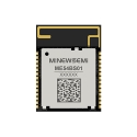
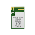
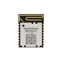
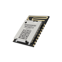
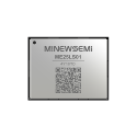
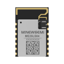
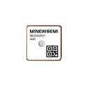
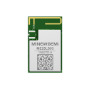
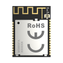
MinewSemi offers GNSS module solutions for developers evaluating positioning capabilities for IoT and embedded applications. When comparing options, review the supported constellations, positioning specifications, interface requirements, antenna configuration, and operating conditions to determine whether a module fits the intended design.
You can explore the available options on the MinewSemi GNSS module product page.
No. GNSS is the general term for satellite navigation systems, while GPS is the U.S. satellite navigation system. GPS is one of the systems that a GNSS receiver may support.
Yes. GPS is one of the major satellite navigation systems included under the broader GNSS category.
Neither term guarantees a particular level of accuracy. A multi-constellation GNSS receiver may benefit from more available satellites and improved satellite geometry, but actual accuracy depends on signal conditions, receiver design, antenna performance, and positioning techniques.
Yes, if the receiver supports both systems and is designed to process their signals together. The available benefit depends on satellite visibility, supported signals, and receiver implementation.
No. Support varies by module. Some modules support several constellations, while others support a more limited selection. Always check the datasheet for supported systems and signals.
A multi-constellation GNSS module may be beneficial for IoT devices that need reliable positioning across different environments. However, the best choice depends on the required accuracy, power budget, cost, operating conditions, and whether additional satellite systems are necessary.
The difference between GNSS and GPS comes down to scope: GNSS is the broader category of satellite navigation systems, and GPS is one system within it.
For many applications, the practical choice is between a GPS-only receiver and a multi-constellation GNSS receiver. Supporting more satellite systems can improve satellite availability and positioning continuity, but it does not automatically guarantee better accuracy.
When selecting a GNSS module, evaluate supported constellations, signal frequencies, positioning accuracy, sensitivity, update rate, power consumption, and antenna requirements together. By matching these specifications to the application's actual needs, developers can choose a positioning solution that balances performance, reliability, and cost.














 Store
Store