


Description
This article highlights key benefits of GNSS surveys and the role that GNSS modules play in achieving them. GNSS surveys are incredibly accurate, allowing for informed decisions and minimizing mistakes. The integration of GNSS module enhances accuracy down to the centimeter level, making it a valuable tool for land surveyors.
In the article, we also discuss how GNSS surveys can save time and money. GNSS modules reduce fieldwork time by streamlining surveying workflow. They also increase productivity. The cost savings are significant for both the client and the surveying firm. GNSS is also highlighted for its versatility and flexibility, which can be used in different modes and to adapt to various environments.
This article also elaborates on other advantages, such as enhanced safety, improved data consistency and reliability and seamless integration with GIS/CAD, improved communication and collaboration in projects, and environmental benefits. Overall, GNSS land surveying, powered by GNSS modules revolutionizes the industry and provides accurate, efficient, sustainable, and diverse solutions.
Global Navigation Satellite System (GNSS), or satellite-based surveying, has revolutionized land surveying by providing accurate and efficient measurements. Professionals in the surveying industry have seen significant benefits with the introduction of GNSS technology. This article will examine three of the key benefits of GNSS and how GNSS modules have contributed to them.
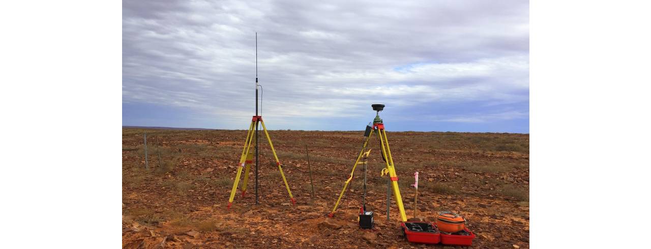
GNSS module for surveying is a powerful tool that can provide measurements with unmatched accuracy. GNSS receivers are able to determine distances and positions with extreme precision by using multiple satellite signals. GNSS modules specifically designed for surveying applications use advanced algorithms and techniques that result in centimeter accuracy.
These measurements with high precision are vital for many GNSS module for surveying tasks such as topographic mapping and construction layout. Professionals can rely on accurate results and reduce errors with GNSS modules. The increased accuracy of GNSS surveys facilitates better decision-making and leads to better planning of projects.
GNSS-enabled surveying offers significant time and cost savings. The traditional surveying methods are often laborious and time-consuming, such as manual measurement and physical markers. GNSS surveys, on the other hand, allow for rapid data collection over large areas and reduce fieldwork time.
GNSS modules improve efficiency by streamlining the workflow of surveying. Surveyors can complete projects faster due to the ease of use and setup, as well as real-time data collection. The increased productivity results in cost savings both for clients and surveying companies, since fewer hours of labor are needed to get accurate results.
GNSS module for surveying also eliminates the need to establish and maintain extensive ground control networks. This reduces costs. Using GNSS modules allows surveyors to achieve reliable results in areas where ground control is limited, reducing the logistical challenges as well as costs associated with traditional methods of surveying.
GNSS surveying is flexible and versatile, and can be used for a wide range of applications. GNSS modules can be operated in various modes such as Real-Time Kinematics (RTK) or Post-Processing Kinematics (PPK), allowing them to meet project requirements.
GNSS surveying's real-time positioning allows surveyors on the field to adjust and monitor measurements in real time, increasing efficiency. This feature is especially valuable for time-critical projects such as construction site surveillance or emergency response planning.
GNSS surveys are not restricted to certain terrains or places. Whether in urban areas where tall buildings block the line of sight or in remote areas that are difficult to access, GNSS module can deliver accurate results. The portability allows surveyors the ability to work in a variety of environments. This makes GNSS receivers an ideal solution for a wide range of surveying applications.
GNSS module for surveying improves safety on the job. Surveyors are often required to work in dangerous conditions when using traditional GNSS module for surveying methods, like busy roads or rugged terrains. GNSS surveys reduce the amount of time on site by reducing the number of physical markers and collecting data faster. Surveyors are able to operate at a safer distance, reducing the risk of an accident and ensuring their safety.
GNSS, powered by GNSS modules offers three main benefits: unmatched accuracy, cost and time efficiency, and flexibility. The integration of GNSS has revolutionized the surveying industry. Professionals can now achieve higher levels in precision, optimize their workflows and adapt to different surveying scenarios. GNSS technology is expected to improve efficiency and effectiveness in land surveying as the technology advances.